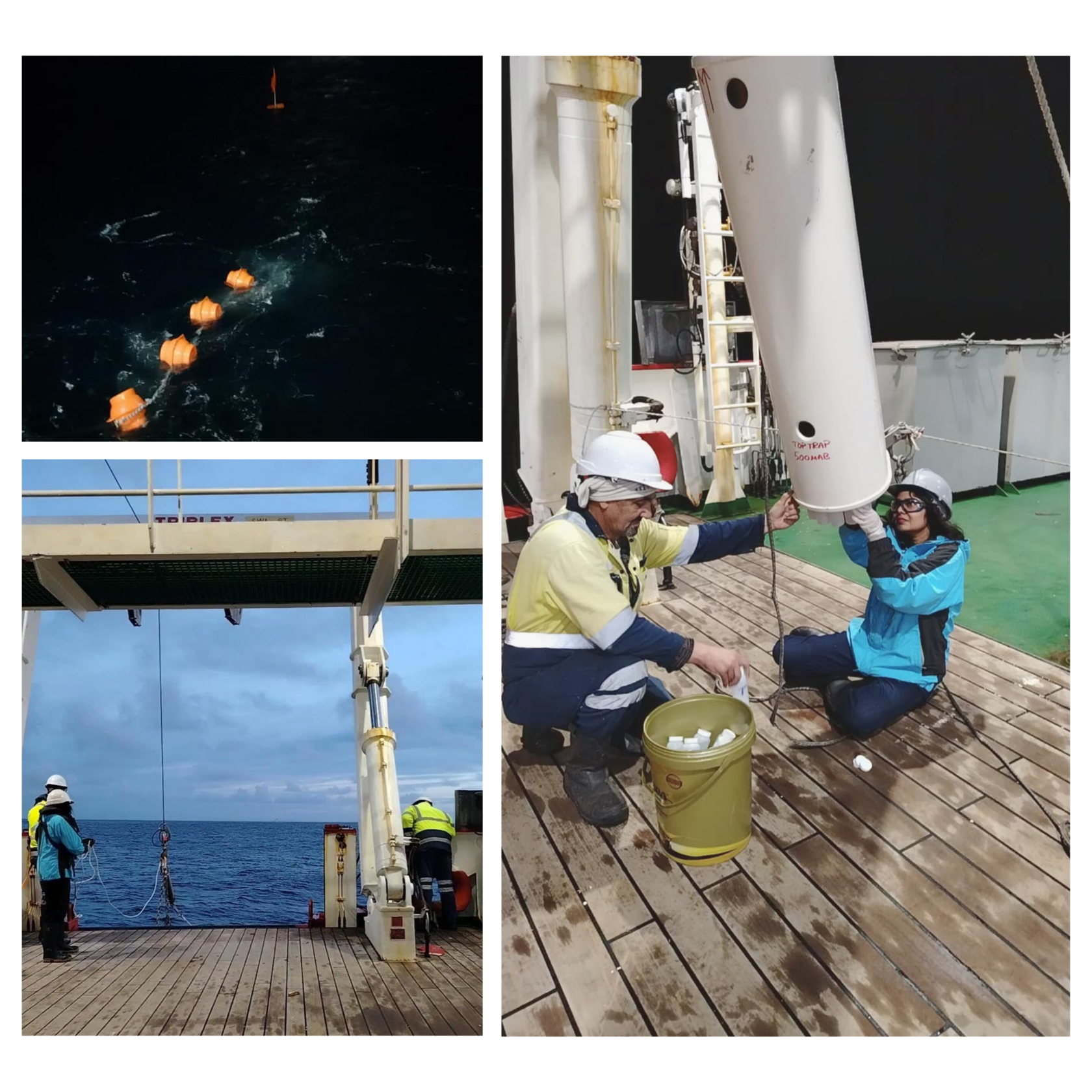
We are thrilled to share a major milestone for OceanSOS! The fieldwork team aboard the SA Agulhas II has confirmed the successful deployment of our first long-term deep-sea oceanographic mooring as part of the Marion Island relief voyage off the southeastern coast of South Africa.
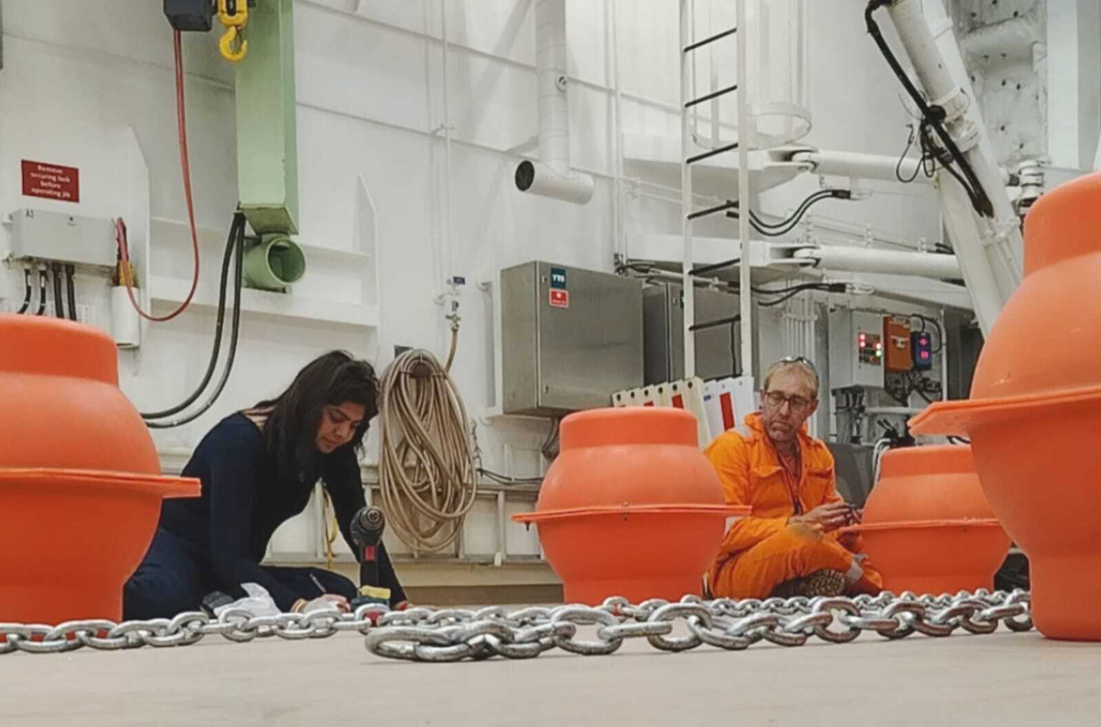
📍 Deployment Details
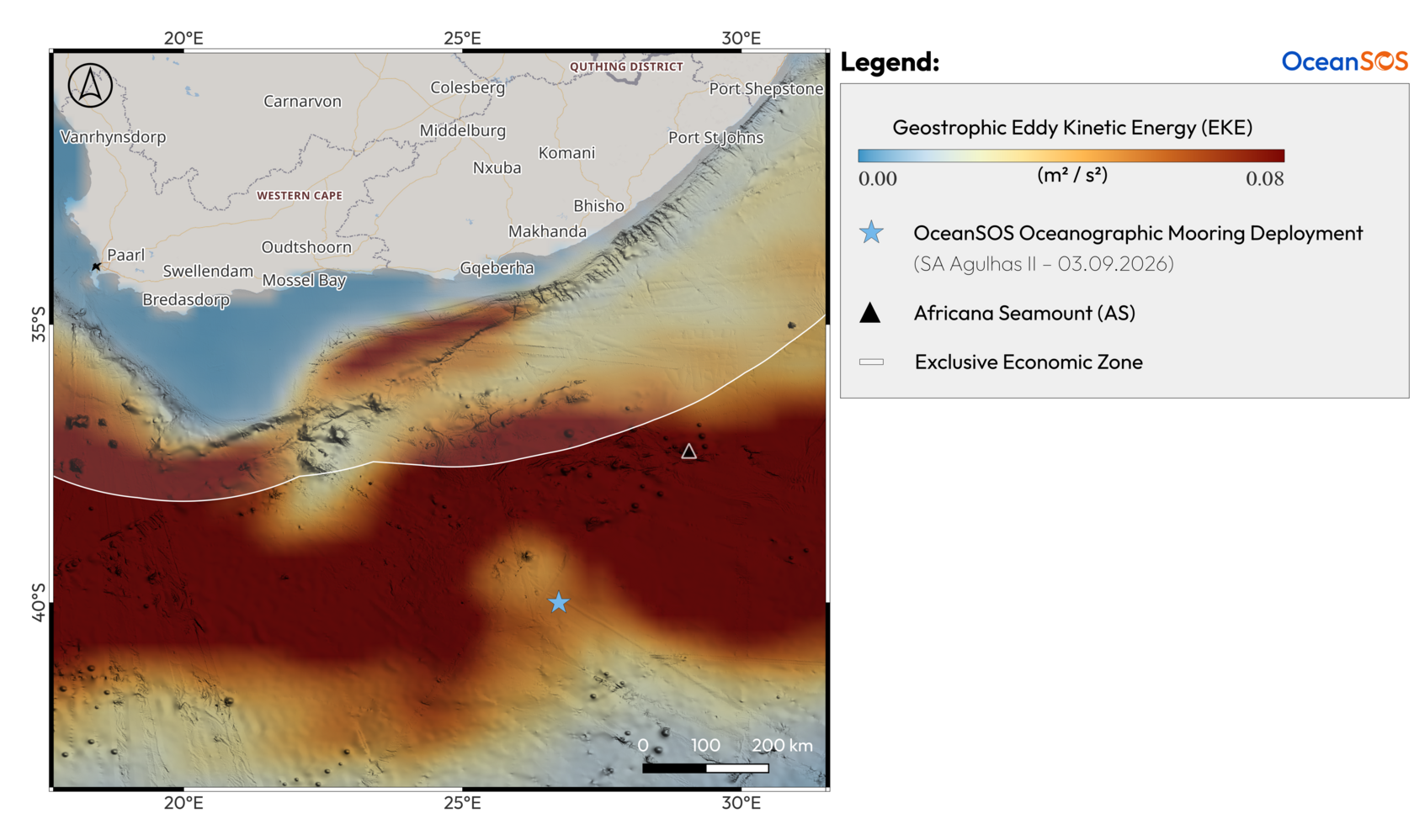
- Location: On the Agulhas Plateau (Agulhas Current System)
- Seafloor Depth: 2,379 metres
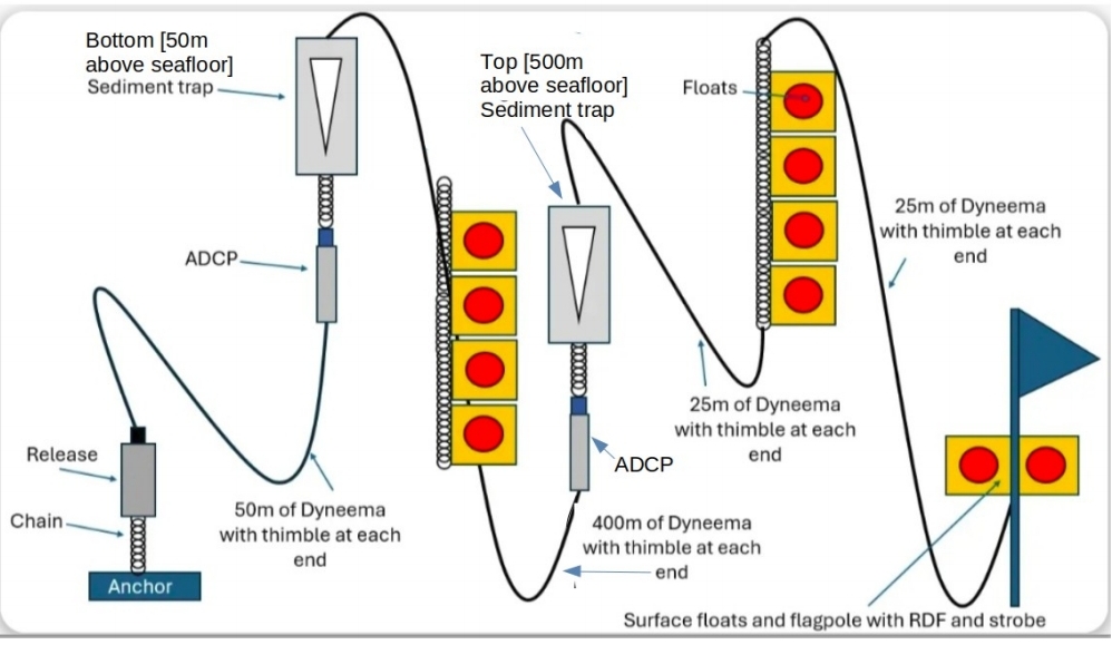
- Mooring Design: 500-metre tall instrumented array
- Target Ecosystem: Mesoscale eddy-influenced seamount & adjacent abyssal plain
- Planned Deployment Duration: 9 months
The Science Behind the Deployment
Led by Prof. Andrew Sweetman (SAMS) and Dr. Sheveenah Taukoor (UCT), this deployment represents a core operational step for Work Package 2 (Physical Oceanography & Climate Change) and Work Package 3 (Biological Carbon Pump).
The Agulhas Current System is one of three core study regions of OceanSOS with globally significant eddy kinetic energy strength. High-energy mesoscale eddies pass over underwater topography like the Africana Seamount, driving exceptional biological productivity. OceanSOS wants to investigate how the Africana Seamount is impacted by the strong upstream variability of the Agulhas Return Flow, and how this variability modifies local seamount dynamics bentho-pelagic coupling and carbon export. However, capturing how these physical forces transport carbon and nutrients requires continuous, in situ monitoring.
To achieve this, the team deployed a specialised 500-metre deep-sea mooring equipped with:
- Technicap Sediment Traps: Positioned in the water column to collect sinking particulate organic carbon over a 9-month period, measuring the strength and composition of the biological carbon pump.
- Nortek Acoustic Doppler Current Profilers (ADCPs): Tracking current speed, direction, and hydrodynamic flow dynamics upstream of the Africana Seamount.
Connecting Field Observations to Earth System Models
The data collected from this 9-month deployment will serve multiple work packages across the OceanSOS consortium:
- Validating Fine-Scale Physics (WP2): Ocean current measurements will validate sub-mesoscale hydrodynamic simulations using the CROCO (Coastal and Regional Ocean Community) model.
- Quantifying Carbon Demands (WP3): Sinking particle fluxes collected by the sediment traps will provide empirical baseline data to calibrate Linear Inverse Models (LIMs) of pelagic and benthic carbon demand.
- Supporting Regional Governance (WP5): Empirical evidence of bentho-pelagic coupling upstream of the Africana Seamount will feed directly into risk assessments and regional Safe Operating Space (SOS) frameworks for Areas Beyond National Jurisdiction (ABNJ).
Next Steps
This deployment was carried out by Dr Sheveenah Taukoor (UCT) during the Marion Island relief voyage 2026 aboard the SA Agulhas II. The mooring will remain on the seafloor for 9 months, gathering continuous data before the planned recovery in 2027.
Huge congratulations to Sheveenah, Andrew, Isabelle, and the entire shipboard scientific and technical crew for a safe and successful deployment! 🌊🚢